![](/images/other/stat-length.png)
![Trail Electric bike Les Mazures - Autour des Vieilles Forges - Photo](https://media.geolcdn.com/t/1900/400/ext.pjpeg?maxdim=2&url=https%3A%2F%2Fstatic1.geolcdn.com%2Fsiteimages%2Fupload%2Ffiles%2F1524743154velo.jpg)
Autour des Vieilles Forges
papadoc
User
![Length](/images/other/stat-length.png)
Length
28 km
![Max alt](https://static1.geolcdn.com/siteimages/upload/files/1508320355ic_sort_altitude_max_24dp.png)
Max alt
375 m
![Uphill gradient](https://static1.geolcdn.com/siteimages/upload/files/1508320355ic_sort_den_pos_24dp.png)
Uphill gradient
508 m
![Km-Effort](/images/other/stat-length.png)
Km-Effort
35 km
![Min alt](https://static1.geolcdn.com/siteimages/upload/files/1508320355ic_sort_altitude_min_24dp.png)
Min alt
221 m
![Downhill gradient](https://static1.geolcdn.com/siteimages/upload/files/1508320355ic_sort_den_neg_24dp.png)
Downhill gradient
507 m
![Boucle](https://static1.geolcdn.com/siteimages/upload/files/16400158638029165_repeat_loop_refresh_sync_direction_icon.png)
Boucle
Yes
Creation date :
2020-05-29 17:15:37.703
Updated on :
2020-05-29 17:19:04.852
![Electric bike](https://static1.geolcdn.com/sitytour/trail-icons/205.png)
--
Difficulty : Medium
![Scan this QR Code to open this trail in the SityTrail application](https://capi.geolives.com/qq0zvz2zws4bq2lad0pu/sitytour/trails/2416092/qr.png?size=200)
FREE GPS app for hiking
About
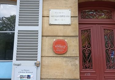
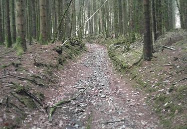
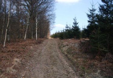
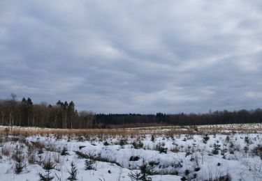
Trail Electric bike of 28 km to be discovered at Grand Est, Ardennes, Les Mazures. This trail is proposed by papadoc.
Description
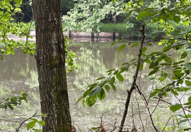
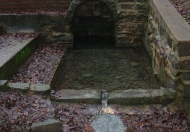
Partez à la découverte du musée de la forêt à Renwez avant de revenir au lac des Vieilles Forges pour une pause détente et vous baigner. Ce circuit est proposé par le Comité Départemental du Tourisme des Ardennes en partenariat avec la FFCT.
Positioning
Country:
France
Region :
Grand Est
Department/Province :
Ardennes
Municipality :
Les Mazures
Location:
Unknown
Start:(Dec)
Start:(UTM)
614649 ; 5525785 (31U) N.
Comments
Trails nearby
![Trail Walking Les Mazures - La Vallée de la Faux et les Roches de l'Empereur - Photo](https://media.geolcdn.com/t/375/260/ext.jpg?maxdim=2&url=https%3A%2F%2Fservices.sitytrail.com%2FGeolivesWS%2FDownloadMedia.ashx%3FTrailID%3D110146%26Media%3D5343_5.jpg)
![Walking Walking](https://static1.geolcdn.com/sitytour/trail-icons/101.png)
La Vallée de la Faux et les Roches de l'Empereur
Walking
Medium
(1)
Les Mazures,
Grand Est,
Ardennes,
France
![](/images/other/stat-length.png)
11.3 km | 15.2 km-effort
3h 0min
![](https://static1.geolcdn.com/siteimages/upload/files/16400158638029165_repeat_loop_refresh_sync_direction_icon.png)
Yes
![Trail Walking Bourg-Fidèle - de Bourg Fidèle à Charleville Mézières - Photo](https://media.geolcdn.com/t/375/260/c6eaa29d-337e-48f9-86e8-8c0522baac64.jpg&format=jpg&maxdim=2)
![Walking Walking](https://static1.geolcdn.com/sitytour/trail-icons/101.png)
de Bourg Fidèle à Charleville Mézières
Walking
Medium
Bourg-Fidèle,
Grand Est,
Ardennes,
France
![](/images/other/stat-length.png)
34 km | 39 km-effort
10h 12min
![](https://static1.geolcdn.com/siteimages/upload/files/16400158638029165_repeat_loop_refresh_sync_direction_icon.png)
No
![Trail Walking Les Mazures - 2022-05-16_12h48m40_SityTrail - 3244407 - dm-par-la-meuse-2022 - Photo](https://media.geolcdn.com/t/375/260/ext.jpg?maxdim=2&url=https%3A%2F%2Fstatic1.geolcdn.com%2Fsiteimages%2Fupload%2Ffiles%2F1553511878bg_sport_marche.png)
![Walking Walking](https://static1.geolcdn.com/sitytour/trail-icons/101.png)
2022-05-16_12h48m40_SityTrail - 3244407 - dm-par-la-meuse-2022
Walking
Very difficult
(1)
Les Mazures,
Grand Est,
Ardennes,
France
![](/images/other/stat-length.png)
14.1 km | 19.2 km-effort
4h 21min
![](https://static1.geolcdn.com/siteimages/upload/files/16400158638029165_repeat_loop_refresh_sync_direction_icon.png)
Yes
![Trail Walking Renwez - 2022-02-02_10h35m35_SityTrail - 2680794 - renwez (1) - Photo](https://media.geolcdn.com/t/375/260/ext.jpg?maxdim=2&url=https%3A%2F%2Fstatic1.geolcdn.com%2Fsiteimages%2Fupload%2Ffiles%2F1553511878bg_sport_marche.png)
![Walking Walking](https://static1.geolcdn.com/sitytour/trail-icons/101.png)
2022-02-02_10h35m35_SityTrail - 2680794 - renwez (1)
Walking
Difficult
(1)
Renwez,
Grand Est,
Ardennes,
France
![](/images/other/stat-length.png)
11.8 km | 14.6 km-effort
3h 18min
![](https://static1.geolcdn.com/siteimages/upload/files/16400158638029165_repeat_loop_refresh_sync_direction_icon.png)
Yes
![Trail Walking Renwez - Parc naturel régional des Ardennes - Photo](https://media.geolcdn.com/t/375/260/3043fc0c-1685-4246-b2d4-633660a326f2.jpg&format=jpg&maxdim=2)
![Walking Walking](https://static1.geolcdn.com/sitytour/trail-icons/101.png)
Parc naturel régional des Ardennes
Walking
Medium
Renwez,
Grand Est,
Ardennes,
France
![](/images/other/stat-length.png)
8.3 km | 10.5 km-effort
2h 42min
![](https://static1.geolcdn.com/siteimages/upload/files/16400158638029165_repeat_loop_refresh_sync_direction_icon.png)
Yes
![Trail Walking Les Mazures - Le tour des roches de l'empereur Les Mazures - Photo](https://media.geolcdn.com/t/375/260/ext.jpg?maxdim=2&url=https%3A%2F%2Fservices.sitytrail.com%2FGeolivesWS%2FDownloadMedia.ashx%3FTrailID%3D1072064%26Media%3Dfix__20181115164104.jpg)
![Walking Walking](https://static1.geolcdn.com/sitytour/trail-icons/101.png)
Le tour des roches de l'empereur Les Mazures
Walking
Medium
Les Mazures,
Grand Est,
Ardennes,
France
![](/images/other/stat-length.png)
11.8 km | 15.9 km-effort
3h 21min
![](https://static1.geolcdn.com/siteimages/upload/files/16400158638029165_repeat_loop_refresh_sync_direction_icon.png)
Yes
![Trail Mountain bike Rocroi - Boucle au Nord-Est de Rocroi - Photo](https://media.geolcdn.com/t/375/260/ext.jpg?maxdim=2&url=https%3A%2F%2Fservices.sitytrail.com%2FGeolivesWS%2FDownloadMedia.ashx%3FTrailID%3D191575%26Media%3D15197_6.jpg)
![Mountain bike Mountain bike](https://static1.geolcdn.com/sitytour/trail-icons/202.png)
Boucle au Nord-Est de Rocroi
Mountain bike
Difficult
Rocroi,
Grand Est,
Ardennes,
France
![](/images/other/stat-length.png)
30 km | 38 km-effort
3h 15min
![](https://static1.geolcdn.com/siteimages/upload/files/16400158638029165_repeat_loop_refresh_sync_direction_icon.png)
Yes
![Trail Mountain bike Rocroi - Boucle VTT de Rocroi à Sévigny la Forêt - Photo](https://media.geolcdn.com/t/375/260/ext.jpg?maxdim=2&url=https%3A%2F%2Fservices.sitytrail.com%2FGeolivesWS%2FDownloadMedia.ashx%3FTrailID%3D191389%26Media%3D14960_3.jpg)
![Mountain bike Mountain bike](https://static1.geolcdn.com/sitytour/trail-icons/202.png)
Boucle VTT de Rocroi à Sévigny la Forêt
Mountain bike
Medium
Rocroi,
Grand Est,
Ardennes,
France
![](/images/other/stat-length.png)
20 km | 23 km-effort
1h 45min
![](https://static1.geolcdn.com/siteimages/upload/files/16400158638029165_repeat_loop_refresh_sync_direction_icon.png)
Yes
![Trail Mountain bike Sécheval - De Sécheval aux Dames de Meuse (sommet) - Photo](https://media.geolcdn.com/t/375/260/ext.jpg?maxdim=2&url=https%3A%2F%2Fservices.sitytrail.com%2FGeolivesWS%2FDownloadMedia.ashx%3FTrailID%3D173137%26Media%3D14696_3.jpg)
![Mountain bike Mountain bike](https://static1.geolcdn.com/sitytour/trail-icons/202.png)
De Sécheval aux Dames de Meuse (sommet)
Mountain bike
Difficult
Sécheval,
Grand Est,
Ardennes,
France
![](/images/other/stat-length.png)
21 km | 26 km-effort
2h 30min
![](https://static1.geolcdn.com/siteimages/upload/files/16400158638029165_repeat_loop_refresh_sync_direction_icon.png)
Yes